Sunday, April 15, 2012

Section 13: Gifford Pinchot State Park to Dillsburg

April 13, 2012
Gifford Pinchot State Park, PA to Dillsburg, PA
section miles: 14     total miles: 161


The day before we reach the AT, and the anticipation is mounting. Not that we want to get it over with, but it’s exciting to be this close and have all these miles behind us. This section brought us back onto legitimate trail and thankfully off the roads for the most part. We drove to our starting point on Pinchot lake, expecting to have the place to ourselves on a Friday, but instead found the parking lots buried in bank-to-bank trucks and trailers. Turns out that today was a Bass Masters tournament on the lake. Fascinating how much technology and horsepower it takes to outwit a fish these days. With a little manual trailer repositioning - when nobody was looking, of course - we managed to squeeze the Mini between a couple of contestants and were off.


The hike around the lake was pleasant, but very muddy in spots. Mostly it was the consistency of firm clay - as-in hey let’s stop and make some pots clay - but several sections were totally under water. Rene stopped to don her wading shoes a few times; I slobbered on as usual, log-hopping until I was sufficiently drenched to not care anymore. We paused briefly to invent soon-to-be-famous “M-DT disc golf”, using some hefty slices of tree logs found conveniently stacked around the official lakeside course. The drivers tend to land with a resounding thud a good thirty feet away, but maybe I wasn’t using the proper wrist action.


Past the lake, a brief section of road-walking through some nice farmland brought us to the State Game Lands, where it was trail the rest of the way. Much of the trail here is new, having recently been approved by the state and relocated off the roads. Which is great! Except... that means the trail doesn’t match the maps, putting you at the mercy of the blazers. Technically we had a revised trail guide to go by, typed up and printed out all nice and neat on a piece of paper from the internet, but technically we left it back in the car (I won’t mention any names). We debated: stick with the old written description (roads) or try and follow the new. A vote was held, and since women’s suffrage hasn’t reached this part of PA (according to me), the majority opted for the new trail.


It went fairly well up to about the mid-way point through the game lands, at which point the trail vanished spectacularly at a road crossing. I wandered up and down the road looking for any clue whatsoever, while Rene folded her arms and tapped her feet with her best I-told-you-so look. A couple of locals were somewhere nearby, unseen but way too close, blasting away incessantly with shotguns as if trying to melt their barrels, which wasn’t helping my case one bit. Eventually we found a questionable blue smudge that appeared to be associated with a dark hole in an otherwise impenetrable mass of underbrush, and in we went like Alice. Fortunately it was the right choice (the M-DT blazers have this maddening habit of putting a nice fresh blaze about 100 yards or more down a trail, way past the point where you need some reassurance). A few more head-scratching moments with some occasional back-tracking, and we finally popped out on the other side of the game lands where our car awaited.
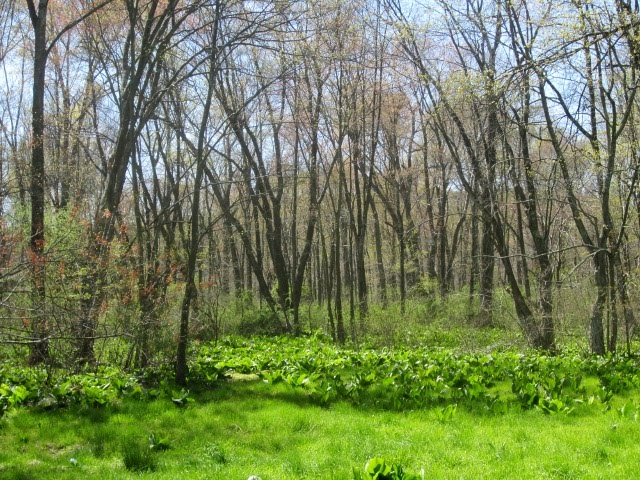


Overall a beautiful, crisp and sunny day, capped off with a spicy date to a mexican restaurant and a visit to the Wegman’s grocery before retiring to our hotel. You know you’ve reached that certain age when a fine grocery store serves up hours of entertainment.

Thursday, April 12, 2012

Section 12: Manchester to Gifford Pinchot State Park

April 8, 2012
Manchester, PA, to Gifford Pinchot State Park, PA
section miles: 14      total miles: 147


As I write this (in arrears), we are packed and ready to leave tomorrow morning for our last two hikes before reaching the western end of the M-DT at the AT. Hard to believe.

Today was just a continuation of our last section - more road walking with little to write home about, except for the last mile when we arrived at the State Park. I’m showing some bland pics of roads because, well, that’s what it is. We did pass by the home of the Michelangelo of chain-saw sculpture (and I regret that I didn’t make note of his name), and spent some time taking photos of his work. We trudged on for hours trying to find somewhere to sit and have lunch, but every inch of land is posted, and eventually we just plopped down on the road berm and hoped the local sheriff didn’t pass by.


Other than that, the big excitement for the day was a return to dog country. Apparently not wanting to be out-gunned by the confederates down Maryland, the Pennsylvania boys around these parts have armed themselves with entire herds of canines. Three rottweilers salivating at the edge of an “invisible fence” is not exactly something I want to walk by, even though the owner calls out from under his truck hood, “Don’t worry, they can’t get ya!” Well maybe so, but we were ready for ‘em... we learned our lesson weeks ago, and now have pepper spray attached to our shoulder straps. My finest hour came when I rightly surmised that an approaching homestead would be dog-ridden and convinced Rene to cross over and swing as far around it as we could. Sure enough, there were... I dunno, maybe a dozen poodle-y things, all about the size of a cat. Let’s just say that I heard about this more than once over the next few miles.


Section 11: Accomac to Manchester

April 7, 2012
Accomac, PA to Manchester, PA
section miles: 14     total miles: 133


From this point on, the “trail” becomes somewhat of an abstract concept, or perhaps more like wishful thinking on the part of the dedicated volunteers at the Mason-Dixon trail organization. Most of it , by far, is simply road walking, as we say goodbye to the Susquehanna river and head west toward the intersection with the AT. Which is fine and interesting in its own right - don’t get me wrong. To their credit, they keep you off the main roads for the most part, and many are lightly-travelled dirt or gravel roads that offer nice walking and the occasional scenic view. But there are also swaths of new construction to wade through, particularly as you pass through the various small towns within commuting distance of York and Harrisburg.


The terrain next to the river has flattened considerably at this point, and we noted our first exposures of Pennsylvanian red-beds as we headed west. Thankfully Rene didn’t find them sufficiently interesting so as to load my pack with samples. We learned some things about half-log construction used in this area back in colonial days, and stopped to admire the Codorus Furnace, a pre-revolutionary iron-smelting furnace that sits forlornly and unceremoniously by the side of the road, where it now serves admirably as a local teen climbing gym and nightclub, judging by the refuse.


I’ll let the photos do the rest of the trail-talking here, but I did want to mention one thing. If you EVER are in the vicinity of York, make a point to stop at the Moonlight Cafe in Dover (just outside of York). It doesn’t look like much on the outside - in fact, it looks like a used-car dealer’s shack, which it very well might have been, because it’s right in the middle of car lots - but this is the best Italian restaurant not found in a major city. Bring cash, bring a bottle of wine, and expect to wait... there are only 12 tables, and it’s very popular.


Sunday, April 8, 2012

Section 10: Long Level to Accomac

March 31, 2012
Long Level, PA to Accomac, PA
section miles: 13 miles     total miles: 119


As usual, I'm behind in real-time, and trying to catch up on these entries, so my memory is fading fast. As I post this, we are past York and just two skips from finishing at the AT.

It's been three weeks since our last section hike, and in the meantime spring has washed over the hills of the Susquehanna. The forest floor, previously buried everywhere in a dull brown layer of fall leaves, is now a verdant carpet of new growth. Beds of day lillies have sprouted up, fiddleheads are curling open, and everywhere you look Virginia bluebells and Dutchman's breeches are in bloom. Not that I'm Joe Naturalist when it comes to wildflowers. I'm more like Joe Wikipedia... I look them up when I get home.


Today, as Rene said, was a walk in the park. Literally, in that some of the most beautiful sections wound their way through the Susquehanna Heritage Parks, and figuratively, in that the hills were few and modest as promised by our acquaintences we made on the last section. It was a gray, misty, foggy day, which somehow seemed just right, as if everything about this day was soft and easy. We paid a small price in wet shoes and took our snack breaks on the hoof to keep moving, but it was all fun.


The trail stays close to the river for most of the section, venturing west a bit to wander through the Native Lands county park, and is a pleasant mix of woodlands, grassy fields, and interesting road walking. The trail also brings you to the top of Highpoint Scenic Vista & Recreation Area, which we hear has wonderful views of the Susquehanna, but today it was totally socked in. With a stiff wind and low visibility, it felt a bit like we were really on a "summit." There are some interesting archeological sites in this area, dating back to the Susquehannock Indians, and the Native Lands park provides a nice guided brochure of the trail which points out several as you pass by.


From Highpoint we made our way downhill and eventually arrived at downtown Wrightsville, stopping in at a local Italian place to get out of the weather and scarf some lunch. First time I've ever hiked with a pizza box full of left-overs tucked in my pack. Dropped in at the historic John Wright foundry to have a look at their store, which is - as you might guess - now a tourist shop for women's shoes, clothes, jewelry, and assorted jams and pretzel dips. We were expecting... I dunno, iron, I guess. They had some hooks and latches tucked away in a far corner, as if they didn't want anybody to actually buy that stuff, but further exploration led me upstairs to an outlet floor of Taiwanese seconds, pallets stacked high with various iron "things"... like metal cows with broken horns and nifty Victorian latches with no latch. The floor was creepy vacant and depressingly junky, so I quickly made my way back down to the pretzel dips and grazed patiently while Rene boosted the local economy.


The last bit of trail north of Wrightsville led us down by the river through some private settlements, ranging from simple camps to artsy homes, before arriving at the Accomac Inn where our car awaited. Throughout the day we had been passing over hills of slate bedrock, which presumably accounted for their relatively gentle topography, but here we skirted below a substantial ridge of quartzite looming above the houses. In places these outcrops formed impressive cliffs that would be a rock-climber's paradise if not situated on private land. I half-expected the trail to head straight up at some point, but thankfully, no.


That's it for our day hikes. We're far enough from home now that we'll finish the last four sections with a couple of overnight trips, so we don't spend half the day just shuttling cars back and forth. The AT seems almost in sight at this point!