Sunday, January 29, 2012
Section 3: Elkton to Northeast
Elkton, MD, to Northeast, MD
section miles: 11.5 total miles: 27.5
At long last we have maps in hand, and had decent enough weather to head out again, leaving Meadow Park in Elkton around 10:00 am and arriving in Northeast, MD around 4:00 pm. I'm not sure where the time went, but averaging less than two miles an hour? It must be all the photo and snack breaks coupled with all the back-tracking to find the trail, because we are most assuredly hiking at a brisk pace when we're on the move. Perhaps our mileage estimates are wrong, but we take those directly from the MDT web site.
Our maps came hand-delivered this week, courtesy of Bob - a very kind, elderly gentleman who is a volunteer with the MDT and lives not far from us in Newark. Having Bob miss our driveway by a good six feet and park his car on the lawn seemed like a reasonable trade-off for this quick response to our request for maps. I mentioned to Bob that his front tire was flat, and then we sent him off with our best wishes and "hope to see you on the trail" goodbyes.
This section began with a short few blocks through downtown Elkton, which is nice, then past the crumbling edges of town onto country roads. We met a couple of boys dragging a rather large puppy away from a frenzied, fenced collection of mongrels. "What do we have here?", we asked. "Half Chesapeake Bay retriever, half pit bull", they responded proudly. Ah. Leave it to Elktonites to invent a breed that can maul you underwater.
The trail takes you down some country roads which are nice enough and afford an occasional glimpse of the bay, but as you would expect in these parts, have no shoulder to walk on, and what little there is is littered with trash. Trucks, SUVs and old muscle cars roar by with enough frequency to keep you jumping from pavement to berm. Resonating from various directions is the seemingly never-ending bark of dogs. I noticed one elderly resident peeking out from behind the curtains, and imagined her to be on constant watch should any socialists decide to take up residence in her neighborhood.
At the end of the road trek you make your way past a couple of church revival camps and then you're into Elk Neck State Forest. And what a remarkable change it is. For the next several miles - the majority of this section - you are hiking through a relatively young hardwood forest with the occasional stand of white pine. The understory is remarkably open - so much so that it was often difficult to follow the trail, given that it was buried under a thick carpet of leaves and blended right in with the rest of the forest floor. Fortunately, in the most difficult spots, the trail maintainers have done an excellent job marking the way. Excellent, but not perfect - we still managed to wander off on what looked like "the" trail many times, only to back-track when we failed to notice any blazes after ten minutes of walking.
As you reach the other side of the State Forest, you begin to pick up the rural outskirts of Northeast, MD, with all their friendly reminders to not trespass nor even so much as cast your gaze upon the rusting hulks of machinery and piles of not-sure-what gracing their property. The Cecil County landfill apparently feels obligated to post no-trespassing signs on every other tree for the duration of the trail boundary (okay, we get it... no trespassing... which is a shame, because I was so looking forward to hiking through a landfill). But that quickly gives way to a short, nice stretch of wildlife sanctuary, then you pop out of the woods along cemetery road in Northeast.
Our motivational plan all along was to hit Woody's Crab House for dinner as our reward for six hours on the trail, but they were closed for a special event. A quick change of plans led us over to Pier 1 where we feasted on crab ravioli, steak and fried shrimp. Highly recommended when you're in town!
Sunday, January 22, 2012
Socked In
Our next leg - Elkton, MD to Northeast, MD - was put on hold again this week due to inclement weather and lack of maps. Ordering maps from the MDT organization is a bit of a black-box, snail-mail operation... hard to tell if anyone is on the receiving end and no idea if and when they'll be shipped.
A mix of freezing rain, sleet and snow hit northern Delaware Friday night into Saturday, leaving a crusty, white carpet on the landscape. We took the opportunity to hit the gym, and then I ventured out on a whim to crunch may way around the David English Trail, a couple-mile loop in White Clay Creek state park. Beautifully quiet in the woods today. White-throated sparrows hopped around the underbrush and seemed unusually tolerant of my presence - I could almost reach out and touch them on occasion. Chickadees and titmice chittered about, and the occasional cardinal glowed like a lightbulb against the white background. I managed to get a distant, fuzzy pic of a pileated woodpecker working his way around a dead tree. It's not unusual to see or hear pileateds around here, but I don't often get close enough for a picture.
Sunday, January 15, 2012
Trail Wandering - Northbound
The weather this weekend cooperated for only 50% of our team - bright and clear, but below freezing with a chilling north wind. We agreed to put the AT trek on hold for a week, hoping for a minor thaw. In the meantime, I got antsy and decided to hike the MDT north from Newark toward Landenburg, PA. I had hoped to make it all the way to Chadd's Ford, but without maps I eventually found myself wandering hopelessly down former farm roads now encroached by McMansions, getting blown off the two-inch shoulder with every passing SUV as I peered down the road for any sign of a blue blaze. After a couple miles of road-walking I gave up and returned back the way I came.
The MDT trail through the White Clay Creek preserve in Delaware and Pennsylvania is beautiful, however, at any time of year. We've hiked this many times, but there's always something new to catch your eye. Today I noticed a beaver dam that I don't recall... but it's probably been there for years. Just for grins I packed my stove so I could boil up a hot lunch on a gravel bar, but freezing numb fingers quickly turned this into an exercise of speed-cooking. Never a good sign when you can sit and watch ice form while you're eating lunch.
I'm not going to count the miles I did this weekend, since I was just fooling around, but they totaled somewhere around 14 miles over two days. The map image shows how much of the trail we've covered so far, with my northbound extension tacked on. The blue markers identify the section end-points. At this scale, it seems like a fair amount, but if you were to see the entire map of the MDT, we've done just a smudge. No matter, they'll start to add up eventually.
Friday, January 13, 2012
Section 2: Elkton to Newark
Elkton, MD to Newark, DE
section miles: 9.5 total miles: 16.0
The starting point for today was Meadow Park in Elkton, MD, heading back toward Newark, DE. This park is situated on the floodplain of Big Elk Creek, and the first mile or so of the hike followed the south bank upstream. Flood deposits were everywhere, from piles of flotsam to substantial sand bars and downed trees. It was difficult to follow the trail, and we bush-whacked for a while before eventually stumbling back on the blue-blazed path. Rene spotted a fox on the opposite bank standing up on its hind legs to get a better look at us, and after a little observation we noticed that there were actually two foxes having a little morning wrastle. A few steps further on we jumped a great blue heron wading in the creek. Signs of an ambitious beaver were everywhere - he seemed to fancy the biggest trees he could get his teeth on, but apparently was easily distracted and never finished the job.
We soon passed by a pond with a skim of ice, and a bit further on came to a large field of rectangular, earthen water reservoirs as the trail wandered further from the creek. Most were empty. Perhaps the water supply for the city of Elkton? (Edit: this is apparently a fish hatchery.) Past another frozen pond, then a scramble up a surprisingly steep, tall bank and we were finally above the floodplain.
After a relatively short jaunt through the woods the trail dumped us out into our first subdivision. This was challenging, to say the least. The trail markers are painted on the curbs, when you can find them... and that’s the challenge. It’s particularly tricky when the trail crosses a road. After spilling out of the subdivision, we had to wander up and down a very busy road looking for any sign of the trail picking up on the other side. At one point we found a blue marker in the side yard of a beat-up looking auto repair shop - either that, or some guy who collected lots of broken, derelict cars - with a friendly “No Trespassing” sign posted right above the blaze. And it was not terribly obvious where the trail went from there. We steeled our nerves, preparing to be yelled at, and strolled quickly through the yard, past a couple rusting heaps and a “Beware of Dog” sign. A couple very well-hidden, questionably faded blue blazes further on in the bushes gave us hope we were on the right path, but we wondered if this was an old path that had been re-routed. Behind the auto shop we came to some town houses, and again had to walk through somebody’s side yard, hoping we were still on the right path. At that point we had no idea where the trail went. We walked up the road in front of the town houses, but saw nothing, so decided to forge on across the street through another field marked “No Trespassing - City of Elkton”. As we neared a gas line we finally found some blazes, but again, they looked suspiciously faded.
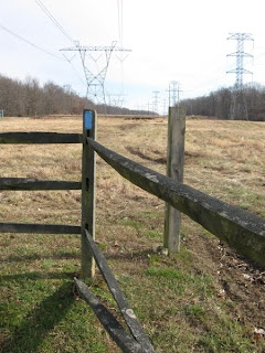
The questionable path eventually dumped us out into a high-voltage power line easement, and bright blue slashes assured us that we were on the official trail again. The trail followed the power lines for several miles. Somewhere near the beginning of that stretch we crossed into Delaware, and towards the end we had a difficult time trying to find the trail at the point where it leaves the power line easement. We spent many minutes wandering around separately in the woods looking for any sign of a trail at all, eventually stumbling upon the right path through a pleasant (but very wet) woodland and into our second subdivision, then emerging onto Old Baltimore Pike across the street from Iron Hill Park.
The Iron Hill walk was wonderful. Excellent trail and a beautiful small park. By strikingly random concidence, we met a group of middle-aged hikers heading south and learned that they too were intending to hike the entire Mason Dixon Trail. They had started in Pennsylvania and were working on their third segment.
Crossing over I-95 from Iron Hill, it was a short jaunt through another small neighborhood, then down the hill to Rittenhouse Park to finish up the segment.
Trekkie Notes
The trail east of Elkton can be very difficult to follow. We promptly decided that we need to buy trail maps - depending on well marked blazes is clearly hit or miss. Low-lying areas adjacent to Big Elk Creek have substantial flood deposits to negotiate, and I think we were off the trail much of the time. The neighborhoods you pass through seem safe enough, but there are a few areas where we kept our eyes peeled for potentially aggressive dogs and property owners. Hiking along the power lines is a tad unnerving, with a constant electric buzz in the background, and a nagging sense that utility company security might show up at any moment to investigate. Four-wheel ATVs tracks are coincident with the trail in many places. In short, a mixed section with a few nice stretches and a few dodgy stretches.
Section 1: Newark South
Rittenhouse Park to Downes Elementary School
section miles: 5.5 total miles: 5.5
We decided to kick off our big adventure by driving to a convenient drop-off point on the south side of Newark and walking northbound back to our house. The trail through this section follows one of the modest tributaries that drain south through Newark into the Christina river. The walk was surprisingly pleasant and interesting, with the low winter sunlight sparkling off the creek beneath a canopy of hardwoods on a rare 60-degree day in January. We spooked a kingfisher, which chattered up and down the creek as we passed by, while numerous cardinals, chickadees and other small winter birds flit around in the underbrush. Turkey vultures teetered overhead, perhaps expecting we’d keel over soon.
Passing under a couple of railroad bridges introduced us to some fairly professional graffiti that we would have never seen otherwise. We cleared one bridge just as a CSX freight train rumbled by overhead. At a busy highway crossing Rene reluctantly accepted my offer for a piggy back ride as we waded the creek beneath the bridge, rather than scramble up and over the intersection. I figured it was a nice opportunity to carry a little weight and experience the oft-described AT pleasure of sopping-wet boots at the same time.
There are the the usual trappings of a suburban hike - some trash along the creek here and there (but not bad), the occasional suspicious dog announcing our presence, rutted and eroded and muddy trail sections in parts, and the periodic glimpse of backyards and shopping centers and industrial lots. But focus instead on the interesting things around every bend - fungi and moss encrusted logs returning to the woodland floor nestled in a bed of ferns, stacks of flotsam marking the high-water points of last-year’s flooding rains, massive trees downed by hurricane-force winds, lakes of standing water perched well above the creek on the floodplain, and deep pools of clear-green water in the creek bed itself.
An interesting beginning. We now look forward to even more adventure and discovery as our section hikes take use further and further from home.
Trekkie Notes
The trail though this section is well marked, and easy enough to follow when it isn't. You're hiking through the city of Newark, not the Delaware Wilderness, so adjust your expectations accordingly and you won't be disappointed. As noted above, some interesting storm and flood deposits through this section. Guaranteed mud in winter and spring; also some bicycle traffic along this trail.May have to wade some sections to get past railroads.
About this Blog
A couple of weeks ago my wife, Rene, and I were hiking along the Mason-Dixon Trail in White Clay Creek State park near our home town of Newark, Delaware, when the nagging thought occurred to us that we really had no idea where this trail came from, nor where it went outside of the park, even though we have trooped around these parts for almost two decades. I say nagging, because it is one of those things that has sat at the bottom of our wanna-do list, which is actually our never-do list, forever. But this time we were determined to scratch it off.
A little research that evening opened our eyes to a remarkable possibility. It turns out the trail runs from Chadd's Ford, Pennsylvania, down into Delaware, crosses a thin neck of Maryland, then back up into Pennsylvania, eventually joining the Appalachian Trail at Whiskey Springs. We could literally step out our front door, walk a couple blocks through our neighborhood to the MDT, and hike to the Appalachian Trail, 160 miles away (or so). Not only that, but one could make a giant loop, if so inclined, and return to Chadd's ford by way of the Horseshoe and Brandywine trails.
Wow. Let's do it.
And so we've started. Our plan is to section hike at whatever pace and intervals meet the demands of our schedule and the weather. To date we've covered two sections, and will be completing our third in a couple days. I'll catch up on those first two hikes in arrears, and then try to stay current as we go along.
For more information on the trail itself, visit the Mason-Dixon Trail organization.