Tuesday, November 27, 2012

Horse-Shoe Section 1

Valley Forge to Brightside Farm
November 23, 2012
section miles: 11.8    total miles: 11.8

I might have been just a tad over-enthusiastic about getting started on our new adventure.  Beautiful day, lovely hike, but a few weeks of lounging around the house made for a long, slow day slogging ENTIRELY UPHILL for hours on end.  Rene claims that there were plenty of downhill sections, so I must have passed out from exertion and rolled downhill unconscious, because I sure don't remember them.  Looks like a few trips to the gym are in order before I attempt the next section.


We started at Washington's Headquarters at Valley Forge park, and just as we reached the trailhead a few hundred yards away, a friendly voice called out asking if we needed directions. We stopped to chat with Dean, a local hiking-and-wine enthusiast sporting an Appalachian Trail hat and a suitably outdoorsy beard, who told us he had just finished the Horse-shoe trail in October.  Thirty minutes of swapping stories and taking photos and we were finally on our way.


I don't intend to spill much ink comparing the Horse-shoe trail to the Mason-Dixon, but a few observations came to mind right off the bat as we started out. The eastern half of the M-DT is mostly on low piedmont and upper coastal plain where the terrain is gently rolling with limited elevation changes.  Easy walking for a hundred miles or so until you reach the steeper hills flanking the west bank of the Susquehanna.  The Horse-shoe trail, on the other hand, kicks off right away with a slow climb up Mt. Misery (appropriately named for a guy in my condition), rising 500 feet or so in the first mile.  From there you get an occasional panoramic glimpse of the surrounding ridge and valley terrain that (I assume) will be navigated by the trail throughout its length.


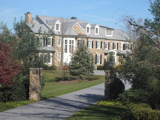
The Horse-shoe is also very nicely marked, especially when walking through subdivisions.  We feel much less self-conscious trooping through somebody's neighborhood with backpacks on when they drive by "Horseshoe Trail" signposts every day, or live on "Horseshoe Trail Road".  The neighborhoods along the trail are quite interesting.  Many homes have exceptional architecture, others have exceptional size, and surprisingly (for modern construction) some combine both. There was a notable lack of pit bulls and rottweilers on this route, but I wouldn't be surprised to meet the occasional slobbering labrador demanding that you toss him a lacrosse ball.


Our slow pace and frequent stops had us dragging into to Brightside Farm by mid afternoon, roughly an hour longer than we expected.  The GPS clocked us at 2 mph for the day, which I'm now beginning to think is some sort of physical constant that the laws of relativity prevent us from exceeding.  Finished the day at the nearby REI, where we had to stock up on all sort of things that were on sale, because, well, they were on sale.  Looking forward to the next section, with one eye on the weather forecast.  Might not be so lucky this year with the warm days in winter.  In the meantime, if you need me, I'll be at the gym.


Thursday, November 22, 2012

Christmas comes early

Happy Thanksgiving!

Rene's nefarious plan to get me to finish the M-DT blog having met with success, she cordially presented me with an early Christmas present - maps and a trail guide for the Horse-shoe trail.  It appears that our hiking days are not ending, but starting anew, so I guess I will need to subtitle this blog somewhat differently.  Previously "Section hiking the Mason-Dixon Trail" will now be "Hiking the mid-Atlantic" or something along those lines.  Naturally, she has the first leg thoroughly researched, and we depart tomorrow for our new adventure.


The Horse-shoe trail is a 140-mile equestrian and hiking path that runs from Valley Forge west to the Appalachian Trail at Stoney Mountain.  The official trail dates from 1935, but portions date back to trails that connected the various furnaces, iron forges and charcoal forests in this part of Pennsylvania as far back as the 18th century.  We've tracked down a few scattered blog and forum entries hoping to get a little insight on the hike, and the best we can tell is that we'll see some road walking early, becoming a bit more rugged hiking as one heads west.  A long-distance runner completed the entire trail in 30-some hours, noting the difficulty of running on shoulder-less roads (walking ain't much better, let me tell ya), finding blazes that marked the way in strategic locations (yup, we hear ya on that one), and the inevitable scourge of pointy little Pennsylvania rocks hiding under a bed of slick leaves (ditto).  Another blogger described his first four miles, filled with hills and houses and pleasant enough until we get to the part where he had to take evasive action to avoid a big, aggressive dog intent on mayhem (why is this starting to sound all-too familiar).

So the plan calls for our now well-honed strategy: take advantage of nice weather, find some open weekends and holidays here and there, try to make about 10-15 miles each day we hike, avoid hunting days, and get it done before hot weather, bugs and storms arrive in the spring. So we're looking at maybe two weeks of hiking to reach the AT again by May.  Can't wait to get started!

Some links:
Horse-shoe Trail Conservancy
Horse-shoe Trail long-distance run
A few words about the trail from a casual hiker family
The first four miles: one guy's day hike (warning: potentially offensive content)


Wednesday, November 21, 2012

Eastern Terminus. Done!

October 26, 2012
Hockessin, DE to Chadds Ford, PA
section miles: 10     total miles: 196


This blog post is brought to you by the Miracle of Christmas. Meaning Rene has threatened to take away my Christmas present if I don't get the blog written before Thanksgiving.  Never one to procrastinate, I still have 6.2 hours to make the deadline.  Which, by the way, is about twice as long as it took us to walk this final section of the Mason-Dixon Trail.


The easternmost leg of the trail is one of those head-scratching, let's walk down roads through random neighborhoods sections that make you wonder about the point of it all, but the weather was lovely and the fall colors were fabulous and we had Hank's Diner waiting at the end.  A young mother jogged by with a baby stroller on a shady road through a woody, wealthy subdivision.   "Are you... HIKING?" she called out, incredulous.  Why yes, we are... sort of.  It's like jogging, only slower.  Much slower, in our case.


There are a few touches of  bona fide trail along the way; maybe two miles or so in total.  The trail guides had noted that we had to "cross a creek", so we hiked all day well prepared with wading shoes and extra socks and hiking poles, only to discover a trickle of water spanned by a tidy little bridge, like something you'd see in a garden.  Further on we stumbled upon an archer sitting in a tree stand with a dead buck sprawled out on the ground about thirty yards away -  a situation that seemed oddly disconnected, like somebody else's deer just happened to expire a short distance from where this guy was perched, perfectly motionless.  I'm not sure who was more surprised: him, us, or the deer. 


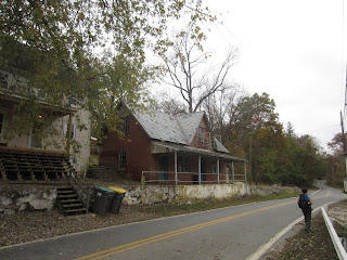
The end of the trail brings you along the floodplain of the Brandywine River, which is scenic but festooned with stinging nettle (memo to self: wear long pants next time).   I had visions of a long hike along the river as it winds out of Chadds Ford, but unfortunately the path was all to short, and before you know it, you are dumped out onto an industrial lane, where one-hundred yards later you reach the eastern terminus of the trail, marked unceremoniously and randomly next to a telephone pole across from some dilapidated building. Dear Trail Guys, we love you, and heartfelt thanks for all the trail effort, but c'mon, man, put the end of the trail at the edge of the woods, not halfway down some alley.  From there it was a life-threatening dash along Route 1 to get across the river to our car parked at the Brandywine Museum.    


This is the part where, having just completed an entire footpath end-to-end, one is supposed to reflect back on the journey as a singular life experience and wax poetic.  But let's just say this: 200 miles is a durn long way to walk in a directional sense (as opposed to say, 800 laps around your high-school track), and we are both proud and astonished that we actually did it.  The walking is easy - one foot in front of the other, repeat for several hours - but it's the planning, the finding time, the getting organized, the putting off of other things, the avoiding all excuses why you can't do it... that's the hard part, and the part Rene tackled with aplomb.  I never could have done it without her.